
Title Page
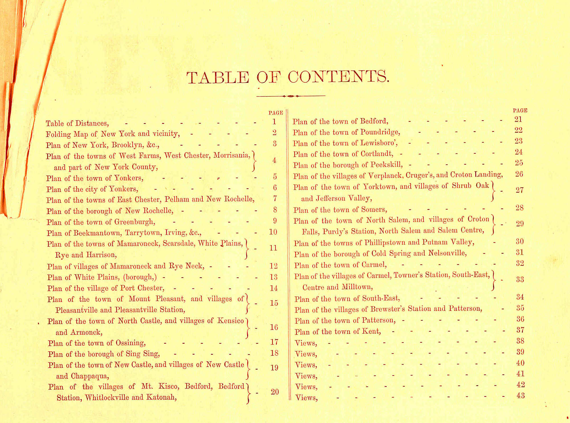
Table of Contents
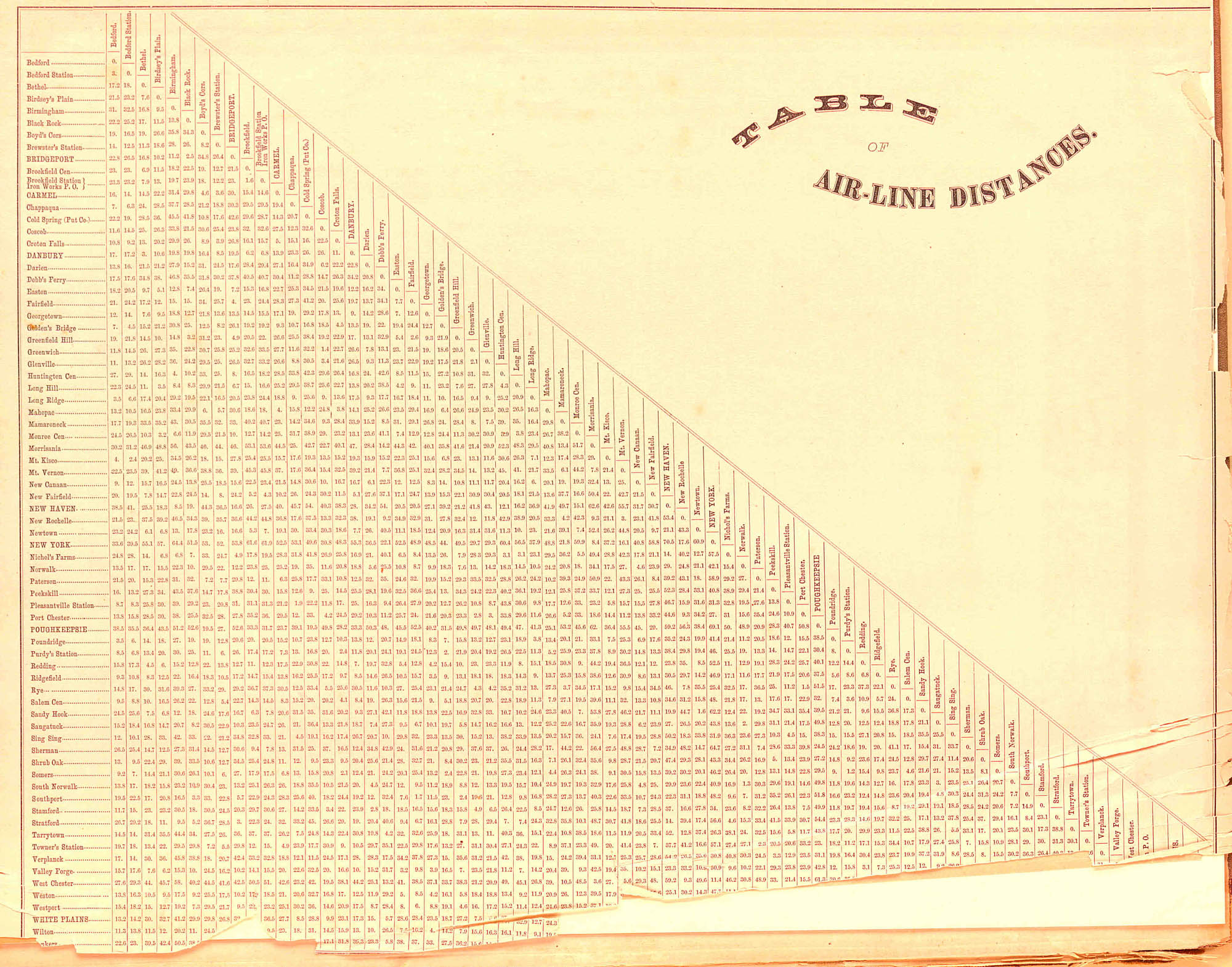
Table of Air-Line Distances
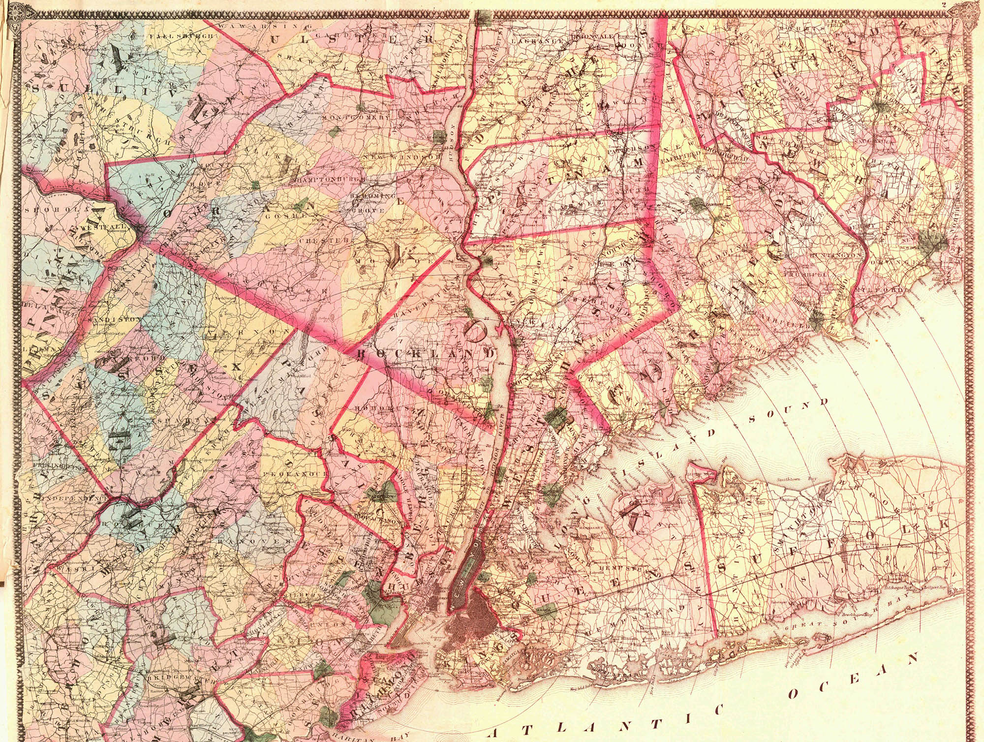
Folding map of New York
and Vicinity
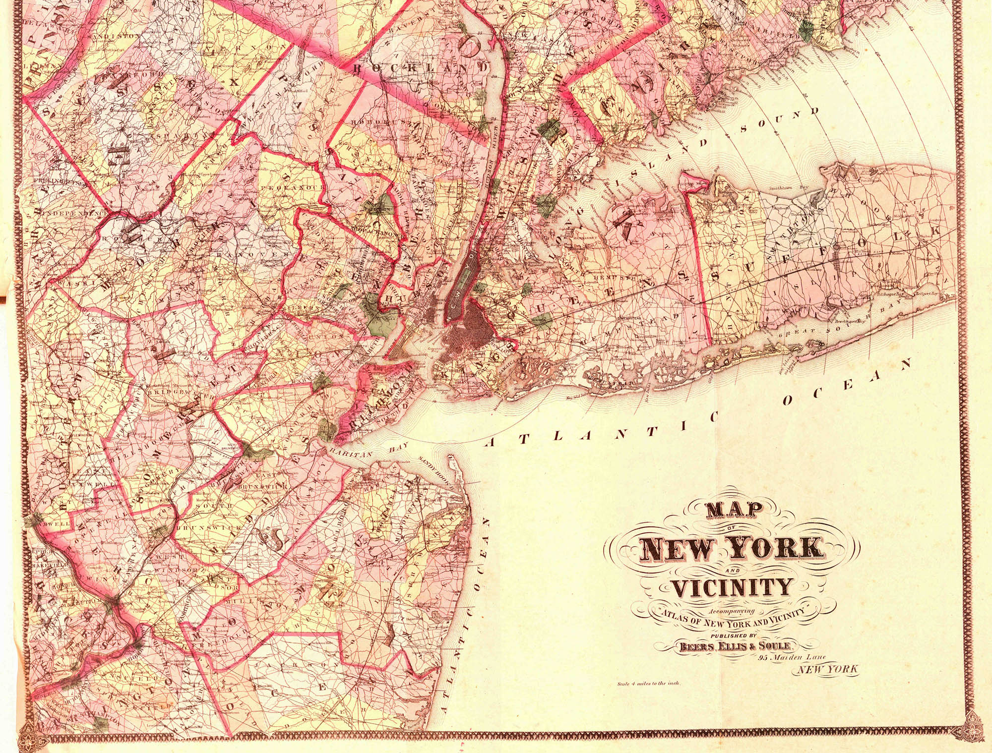
Folding map of New York
and Vicinity
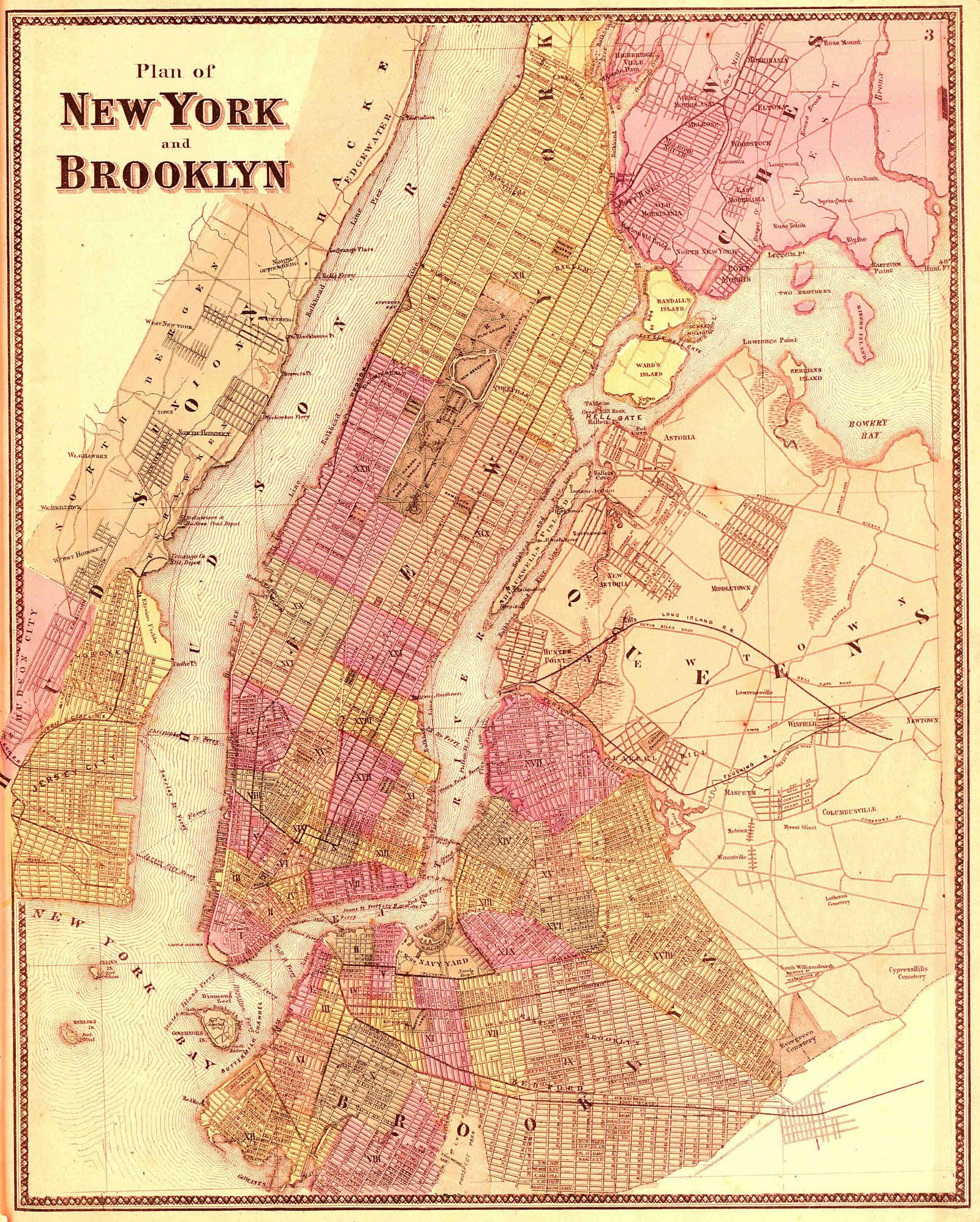
Plan of New York, Brooklyn, etc.
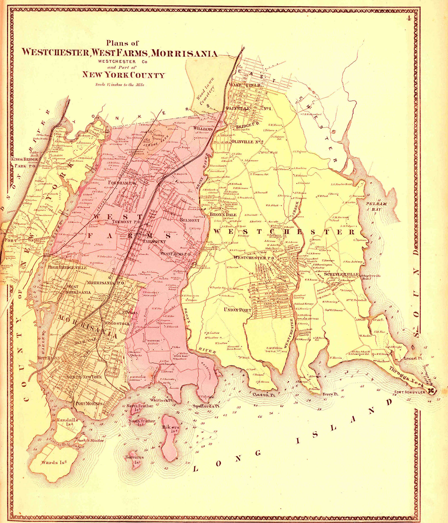
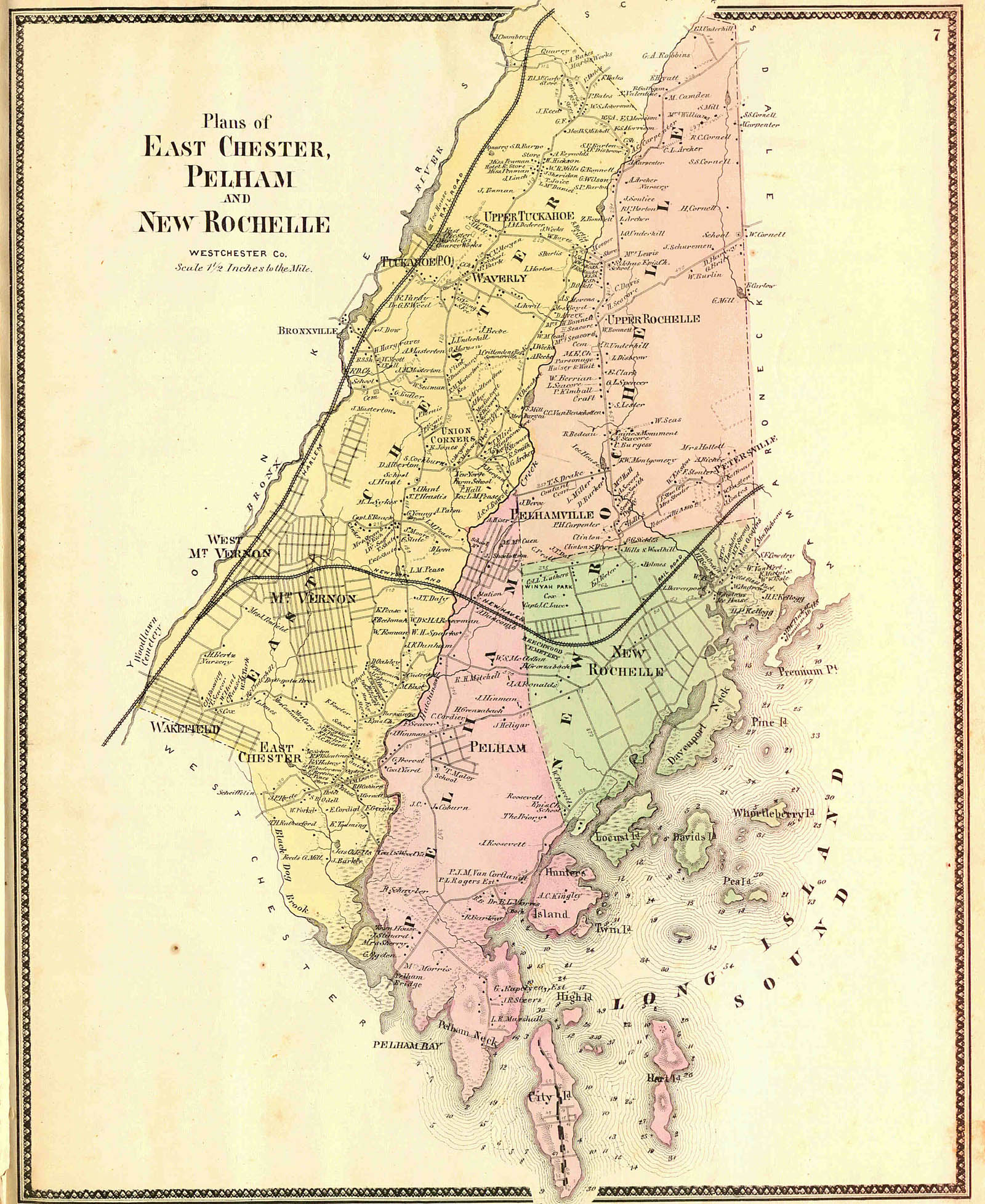
Plan of the towns of West Farms, West Chester, Morrisania, and part of New York County
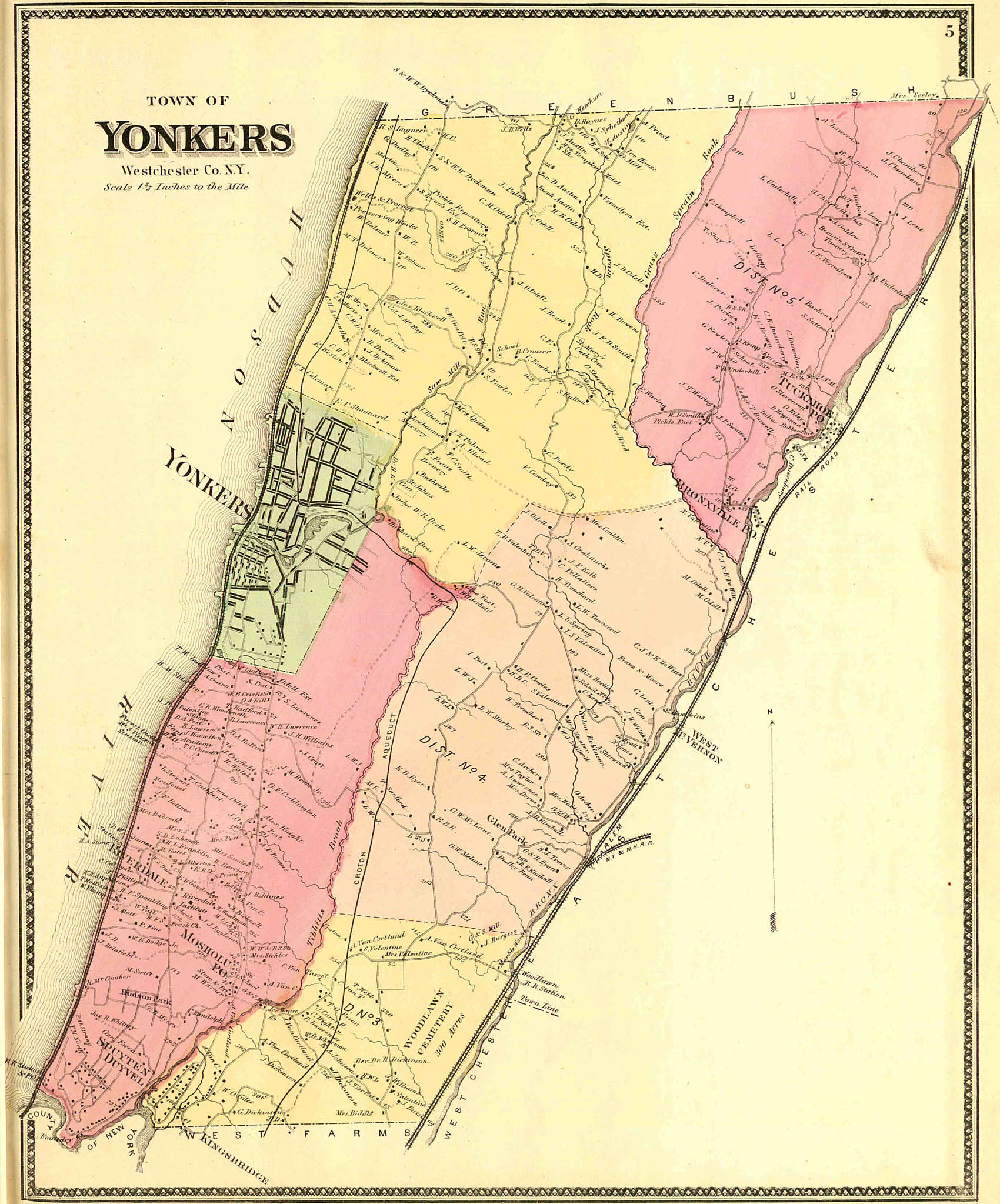
Plan of the town of Yonkers
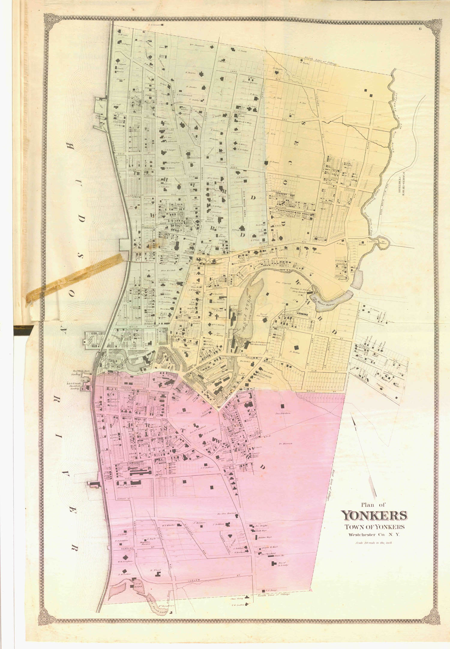
Plan of the city of Yonkers
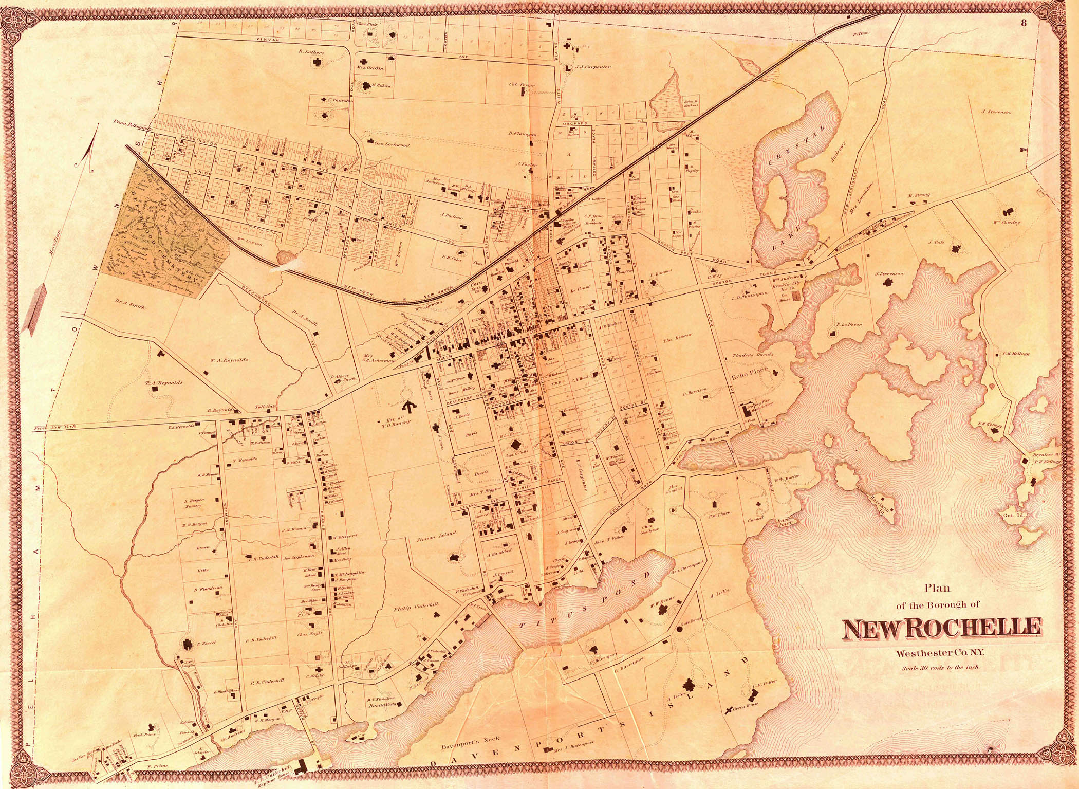
Plan of the borough of New Rochelle
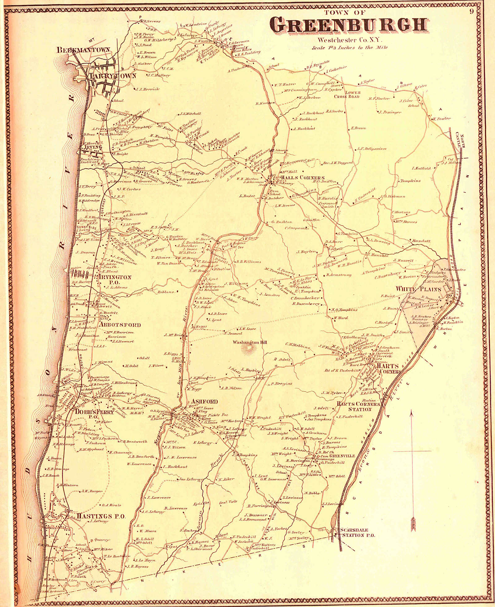
Plan of the town of Greenburgh
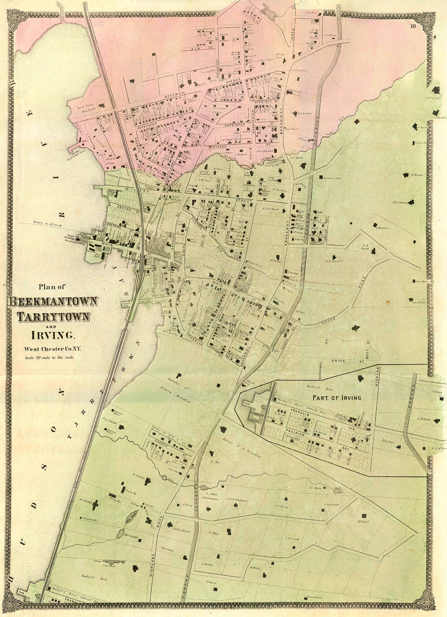
Plan of Beekmantown, Tarrytown, Irving, etc.
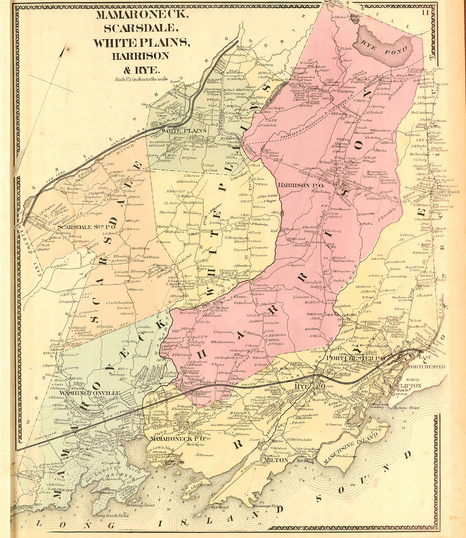
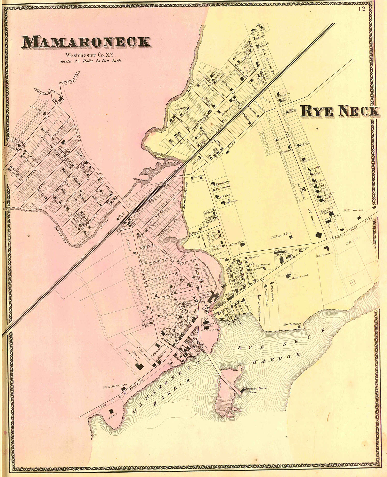
Plan of villages of Mamaroneck and Rye Neck
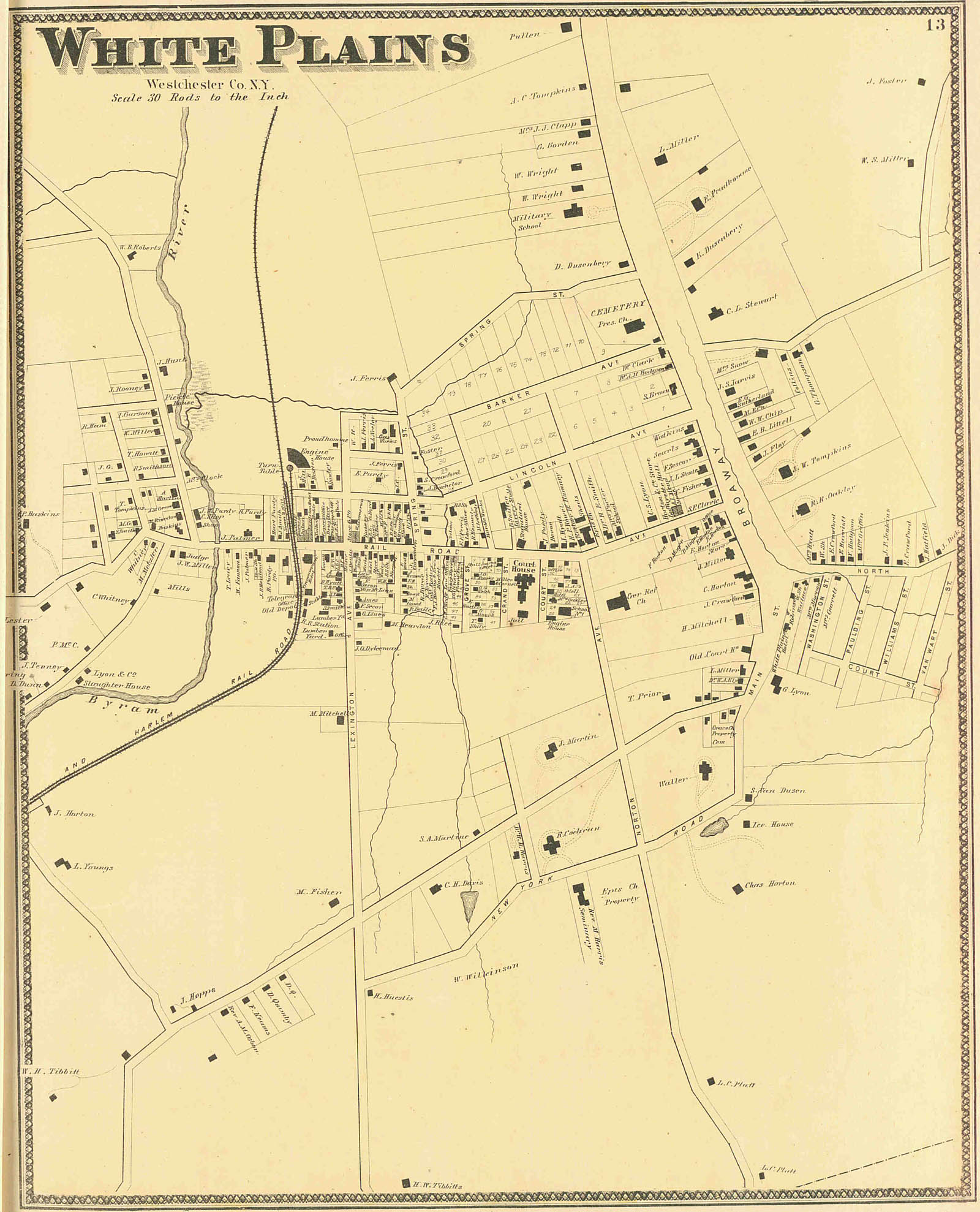
Plan of White Plains, (borough)
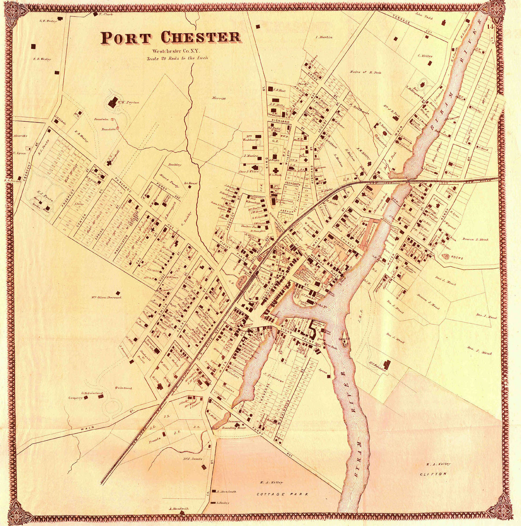
Plan of the village of Port Chester
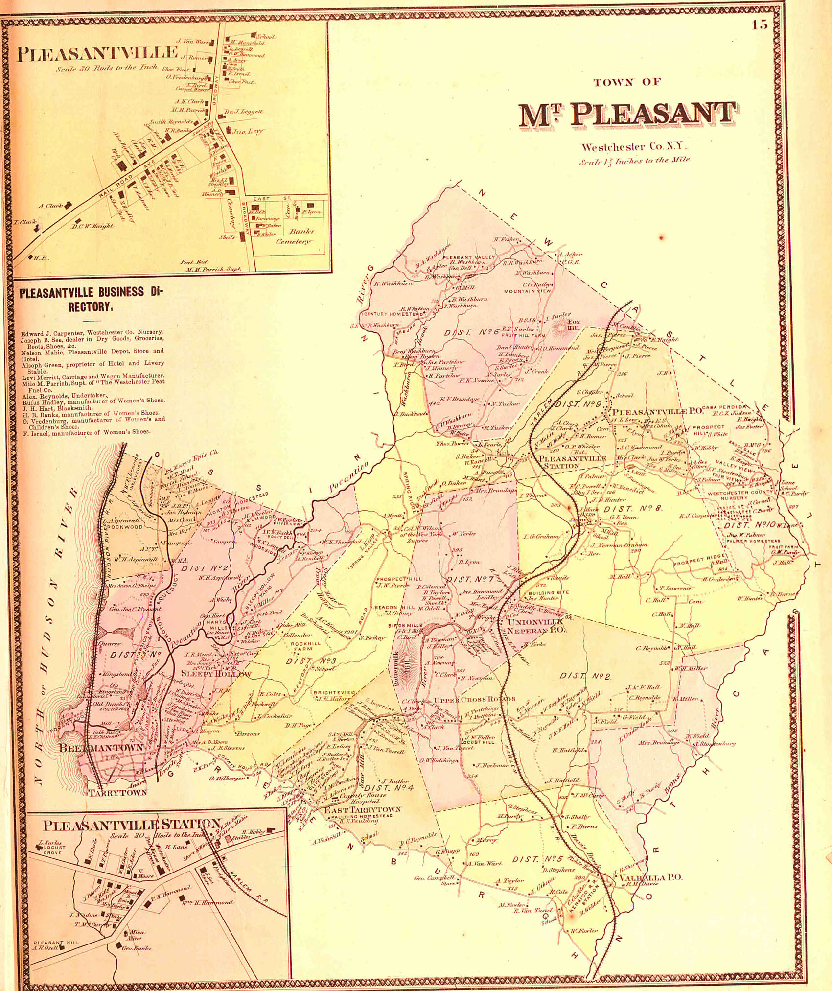
Plan of the town of Mount Pleasant, and villages of Pleasantville and Pleasantville Station
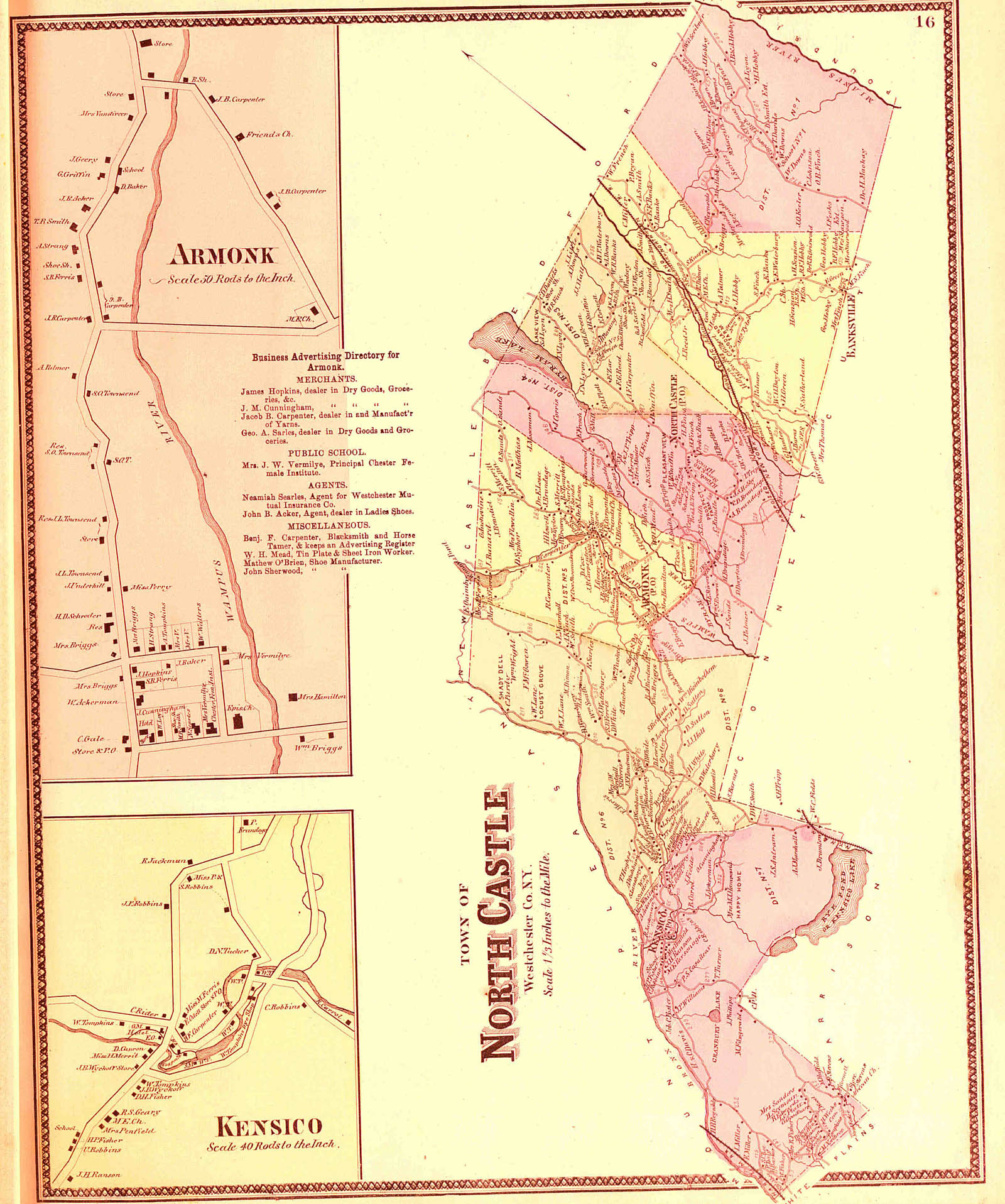
Plan of the town of North Castle, and villages of Kensico and Armonk
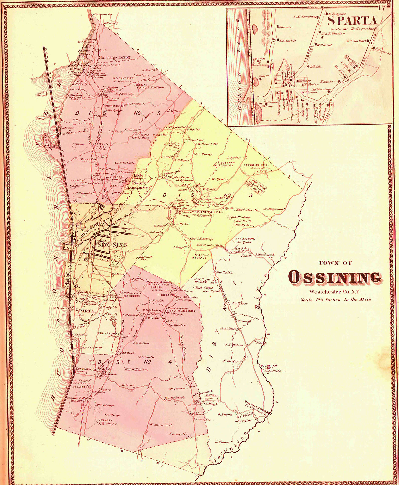
Plan of the town of Ossining
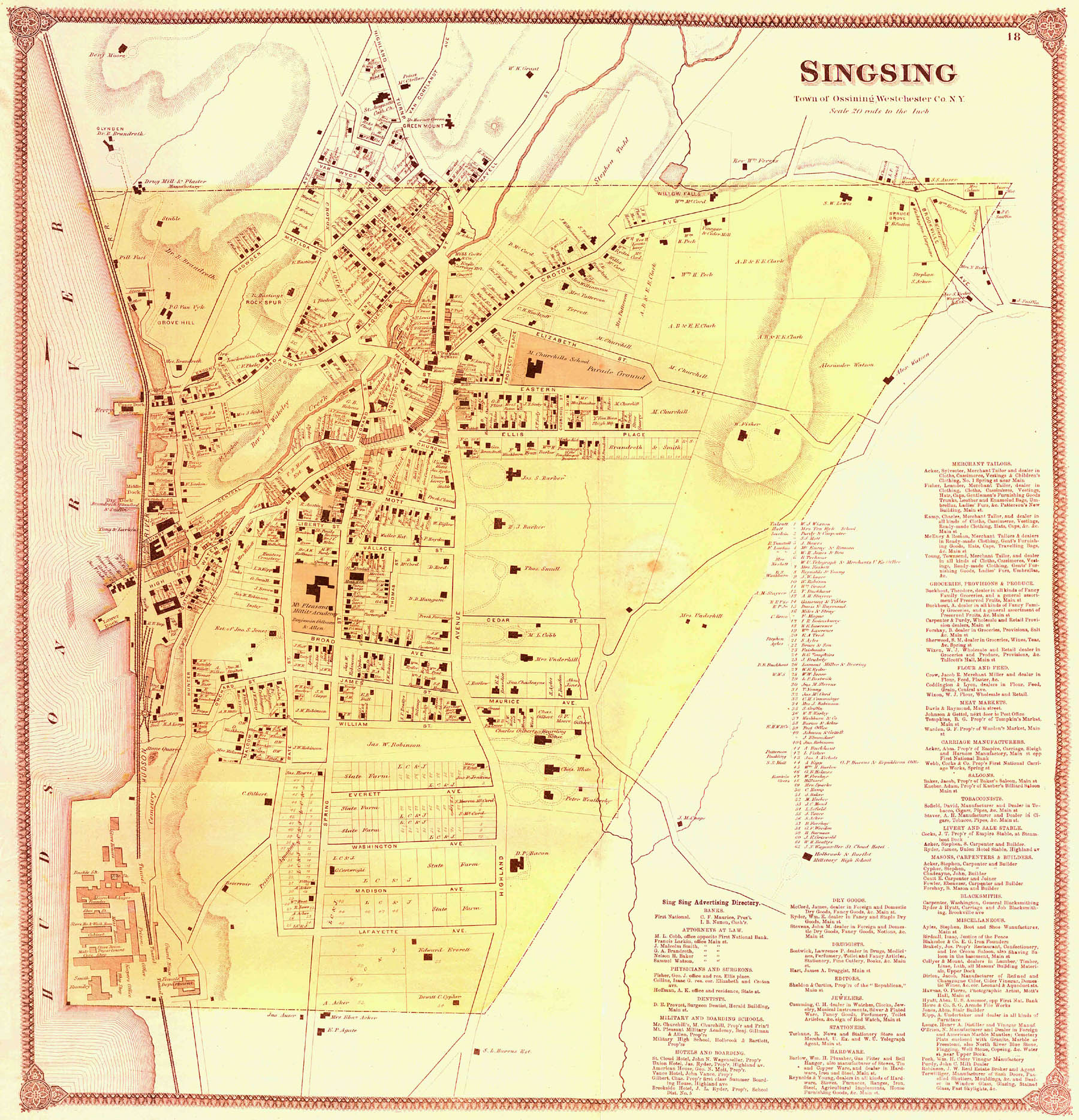
Plan of the borough of Sing Sing
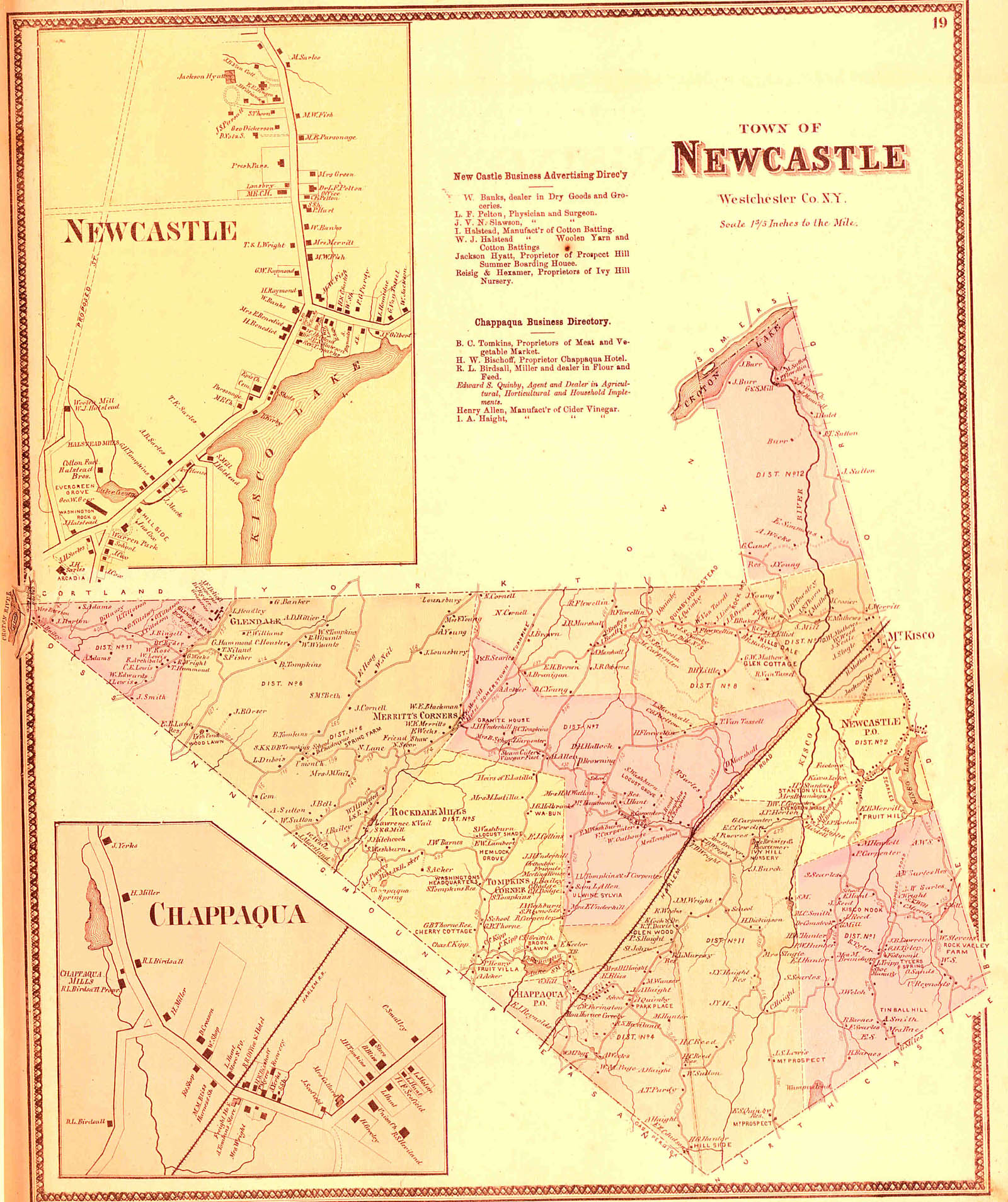
Plan of the town of New Castle, and villages of New Caslte and Chappaqua
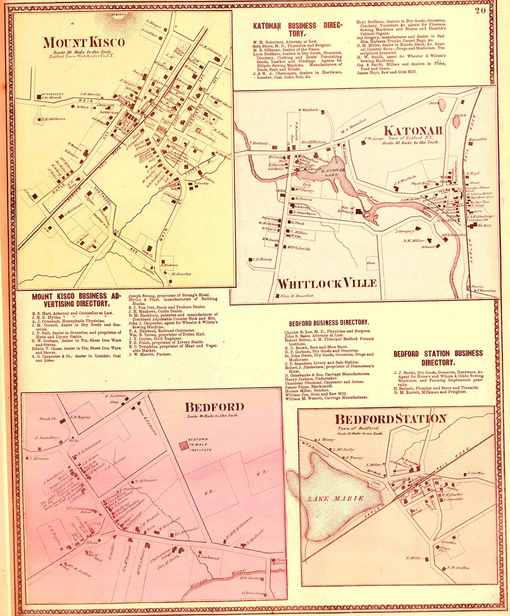
Plan of the villages of Mt. Kisco, Bedford, Bedford Station, Whitlockville and Katonah
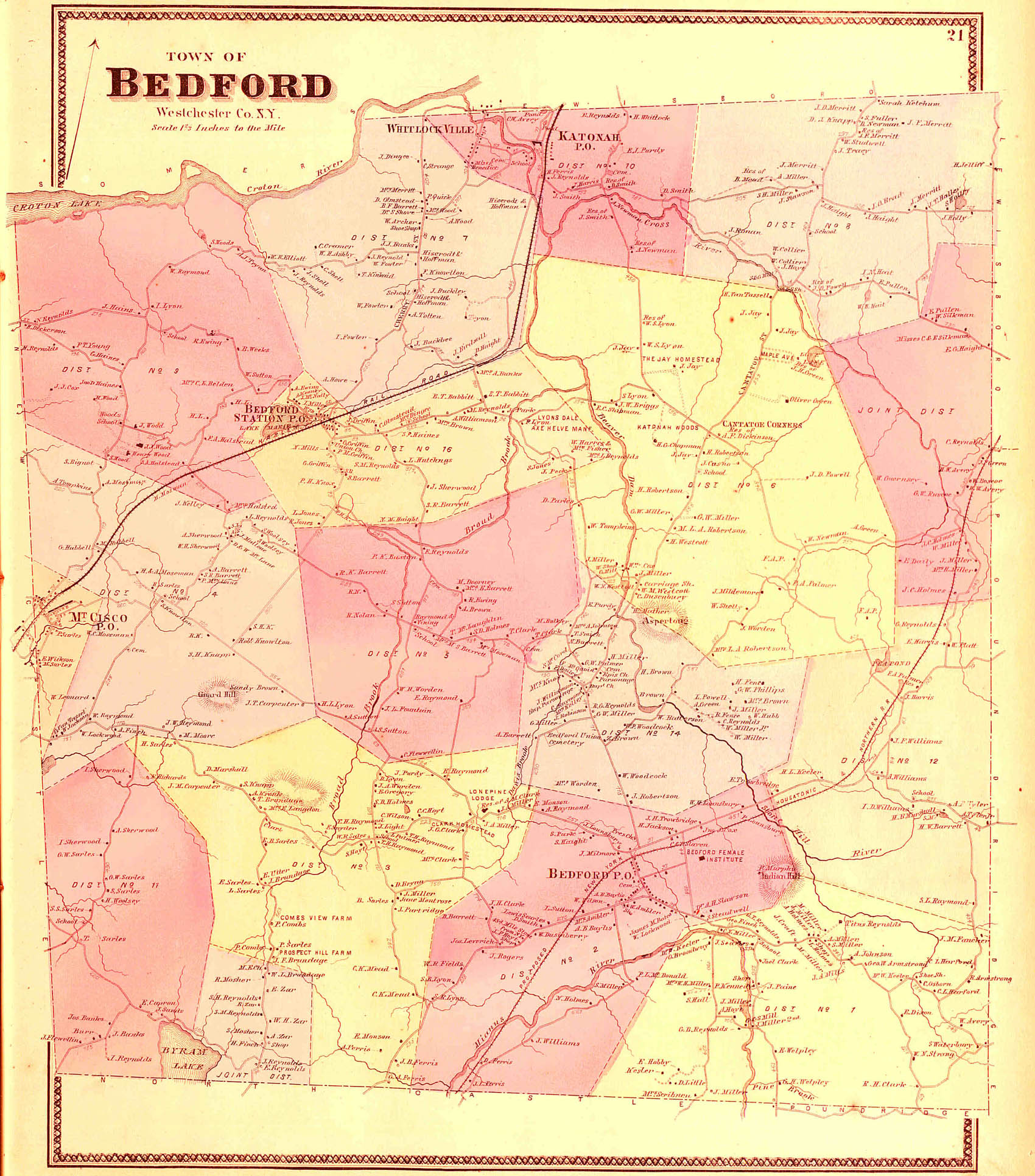
Plan of the town of Bedford
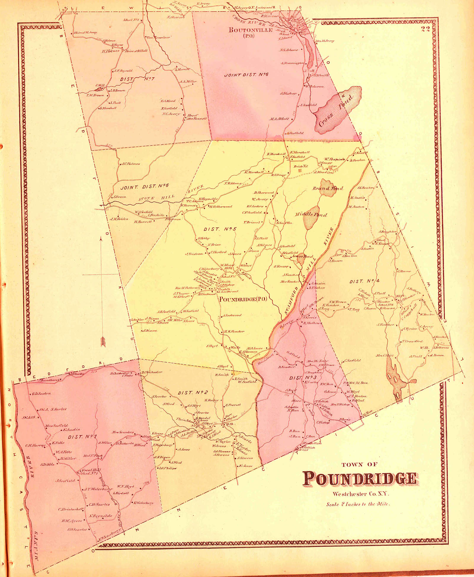
Plan of the town of Poundridge
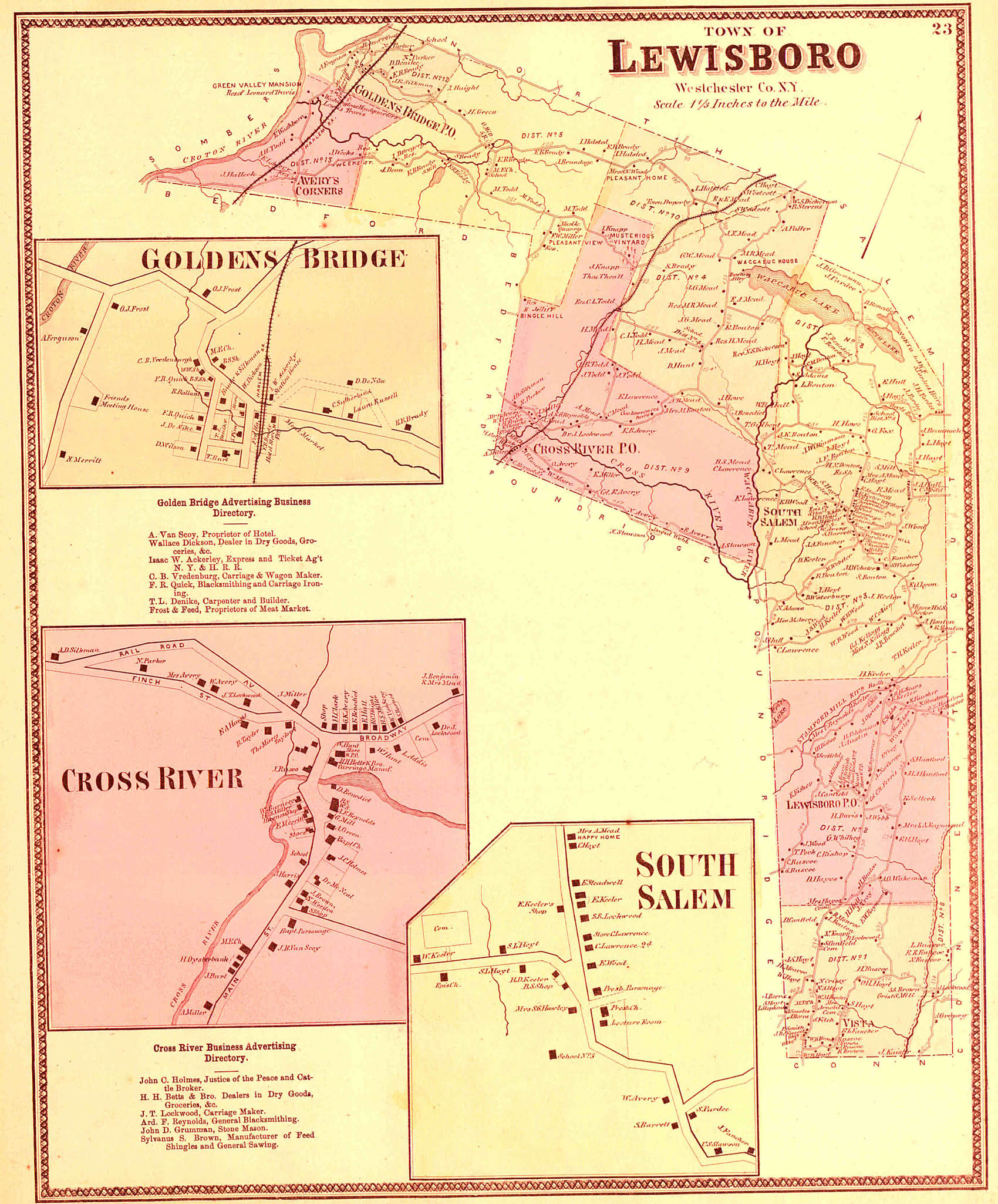
Plan of the town of Lewisboro
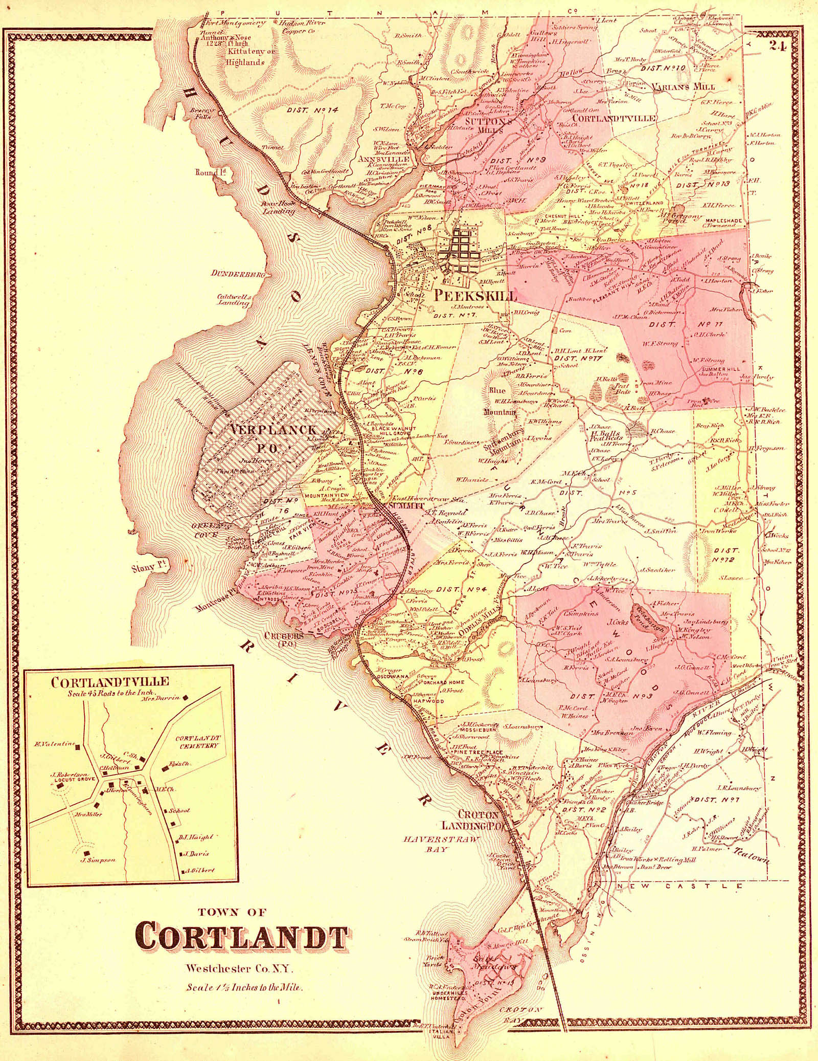
Plan of the town of Cortlandt
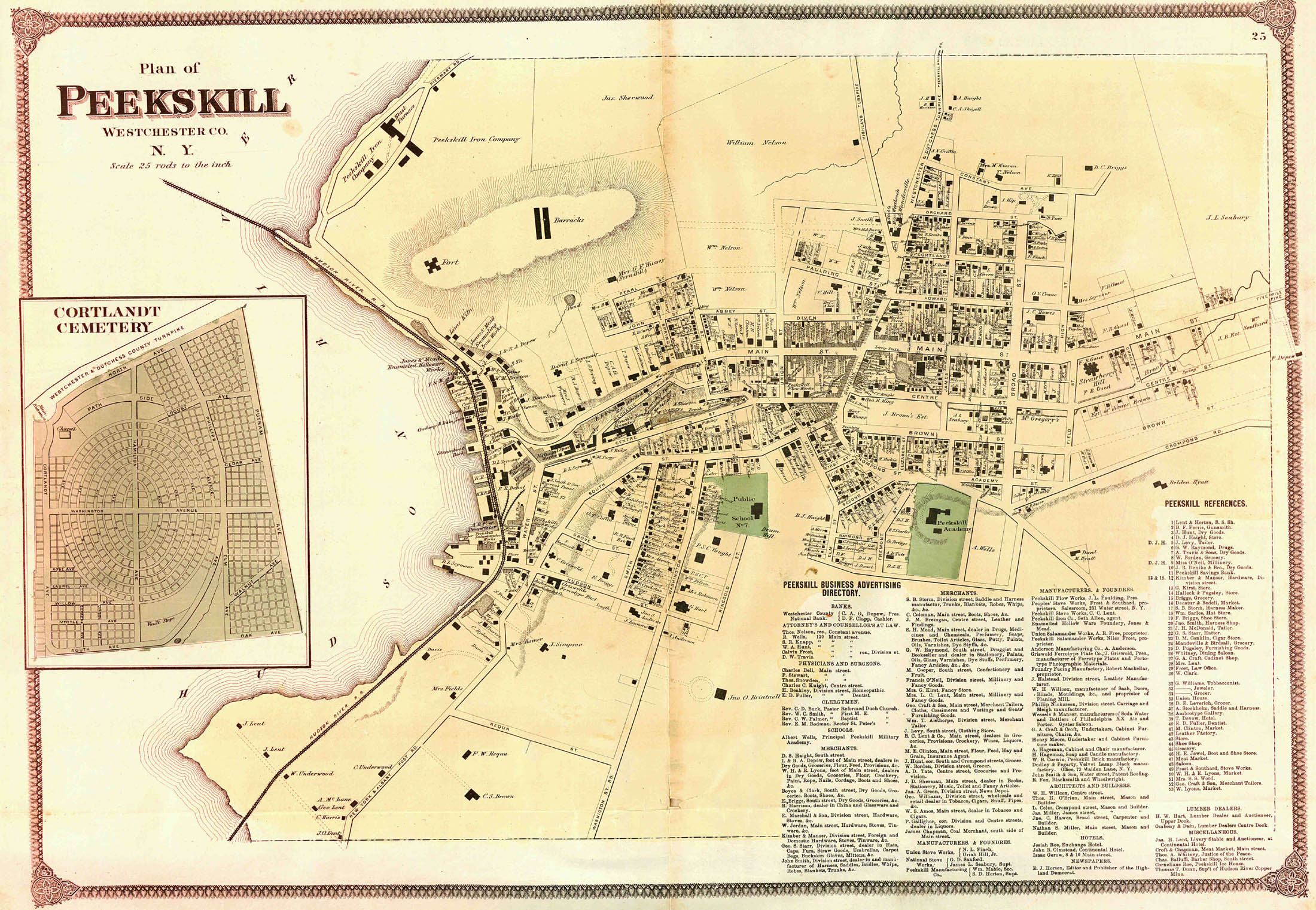
Plan of the borough of Peekskill
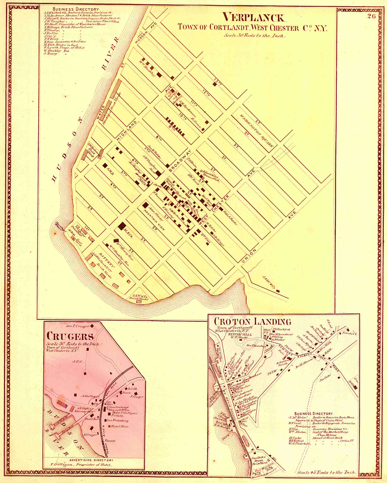
Plan of the villages of Verplanck, Cruger's, and Croton Landing
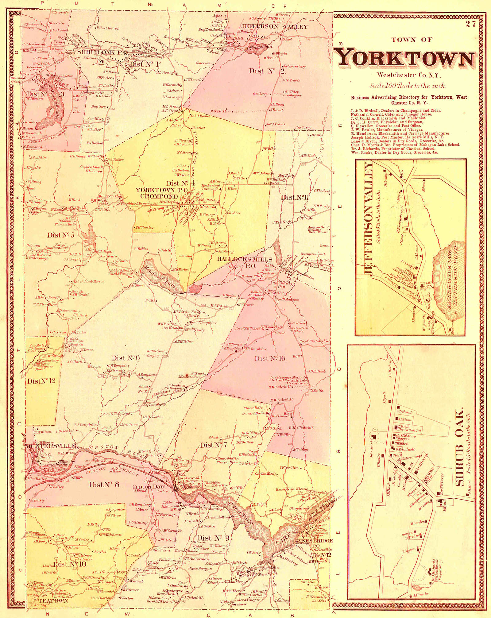
Plan of the town of Yorktown, and villages of Shrub Oak and Jefferson Valley
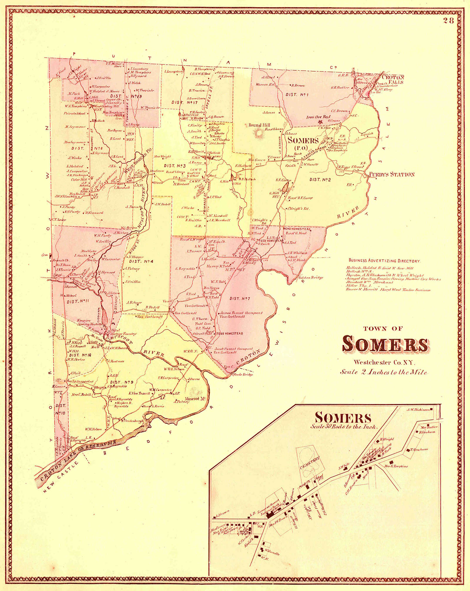
Plan of the town of Somers
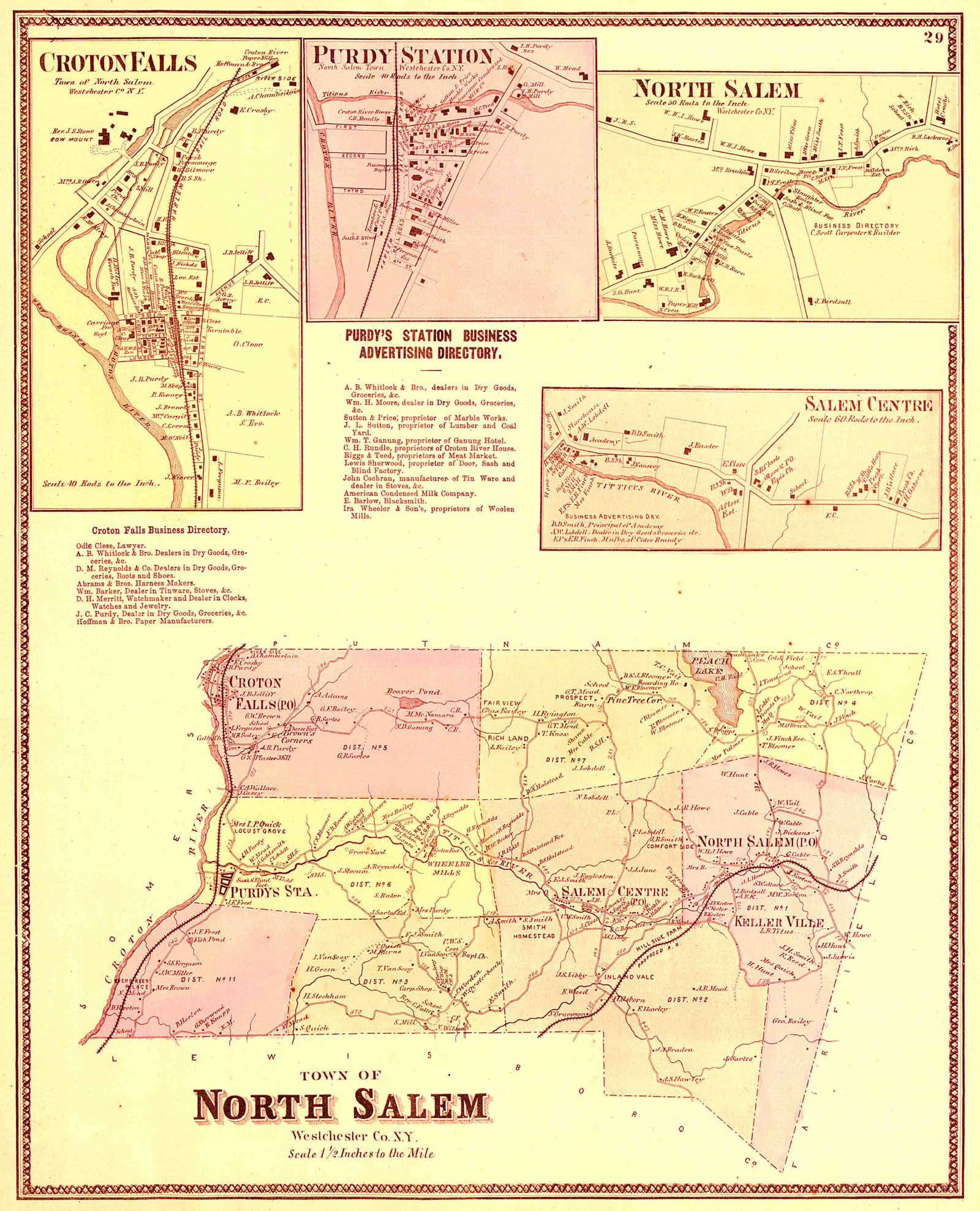
Plan of the town of North Salem, and villages of Croton Falls, Purdy's Station, North Salem and Salem Centre
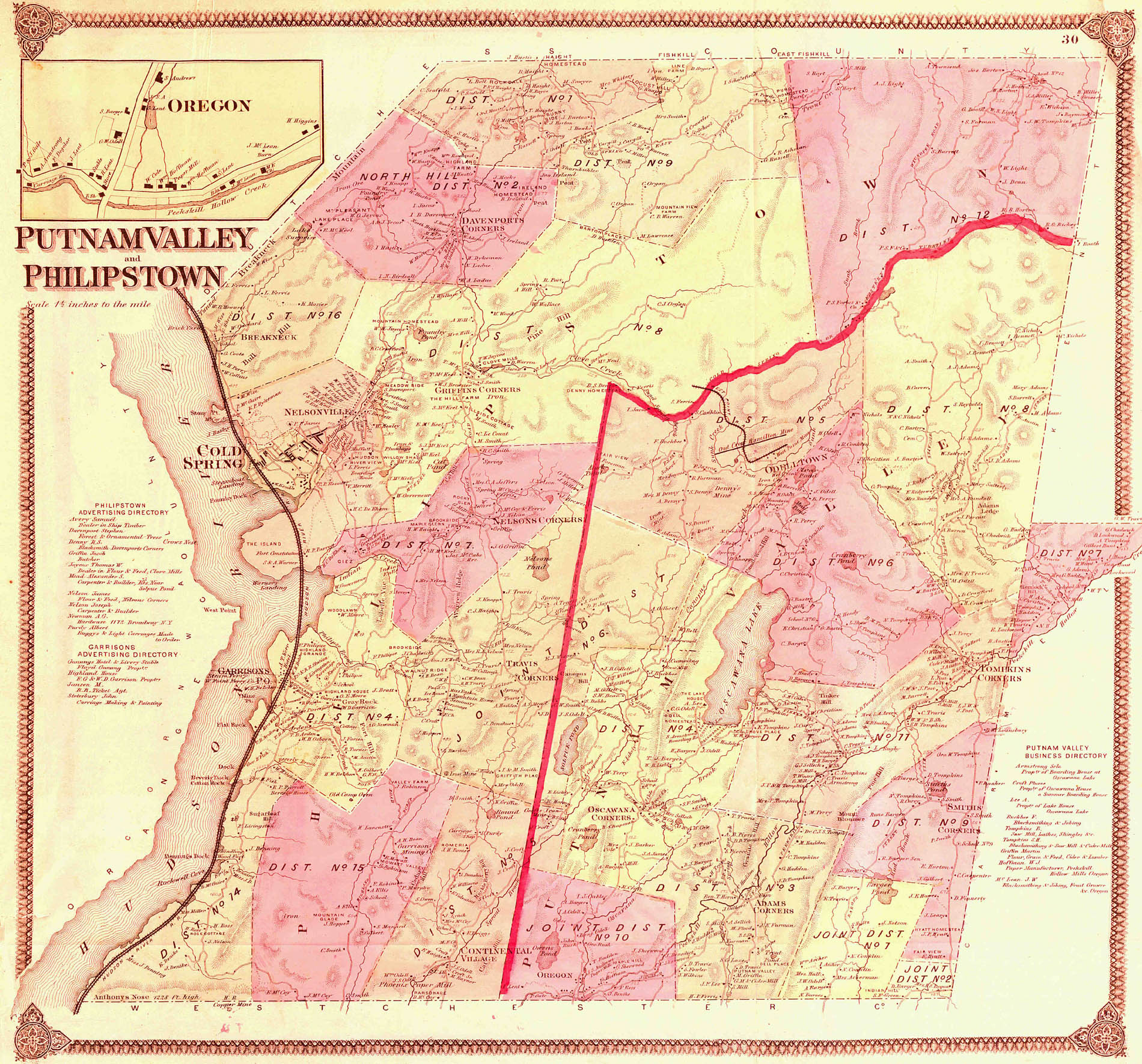
Plan of the towns of Phillipstown and Putnam Valley
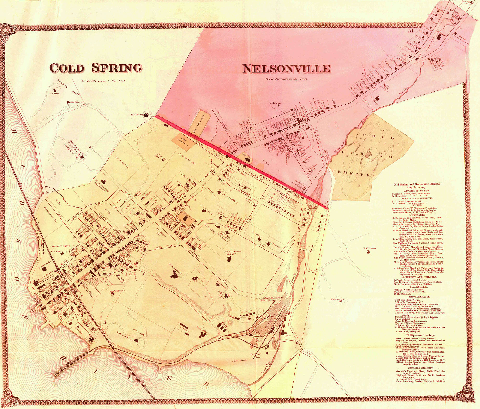
Plan of the borough of Cold Spring and Nelsonville
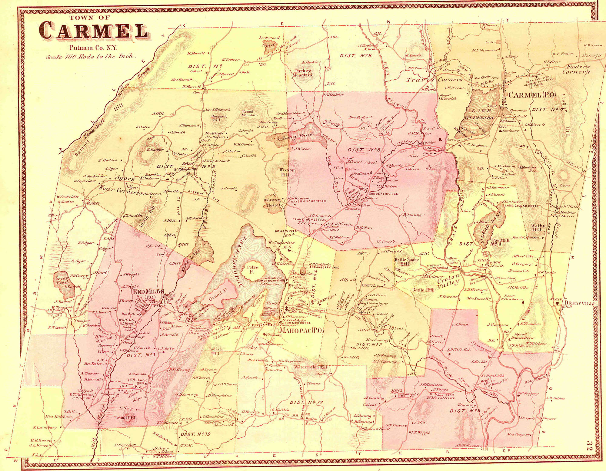
Plan of the town of Carmel
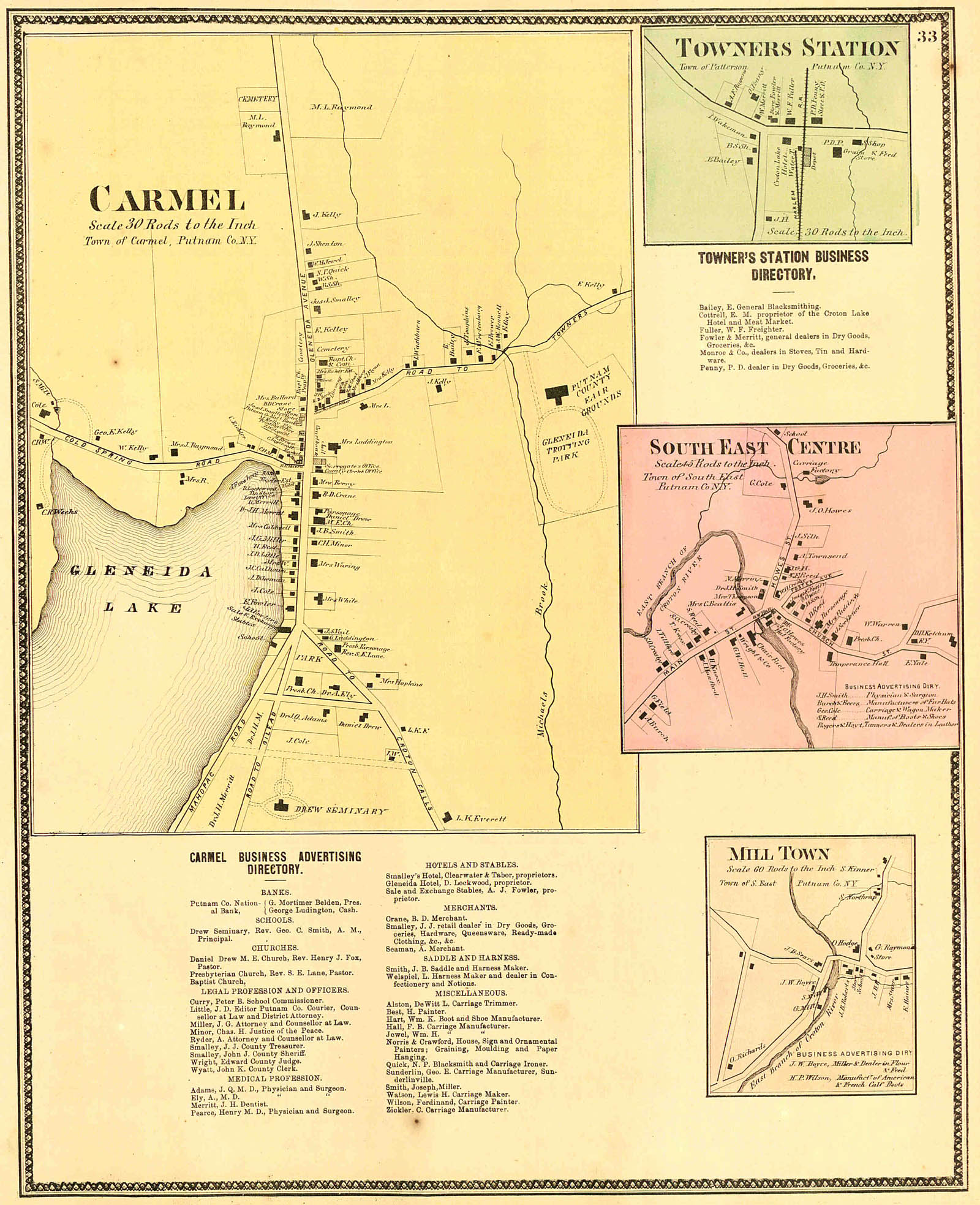
Plan of the villages of Carmel, Towner's Station, South-East, Centre and Milltown
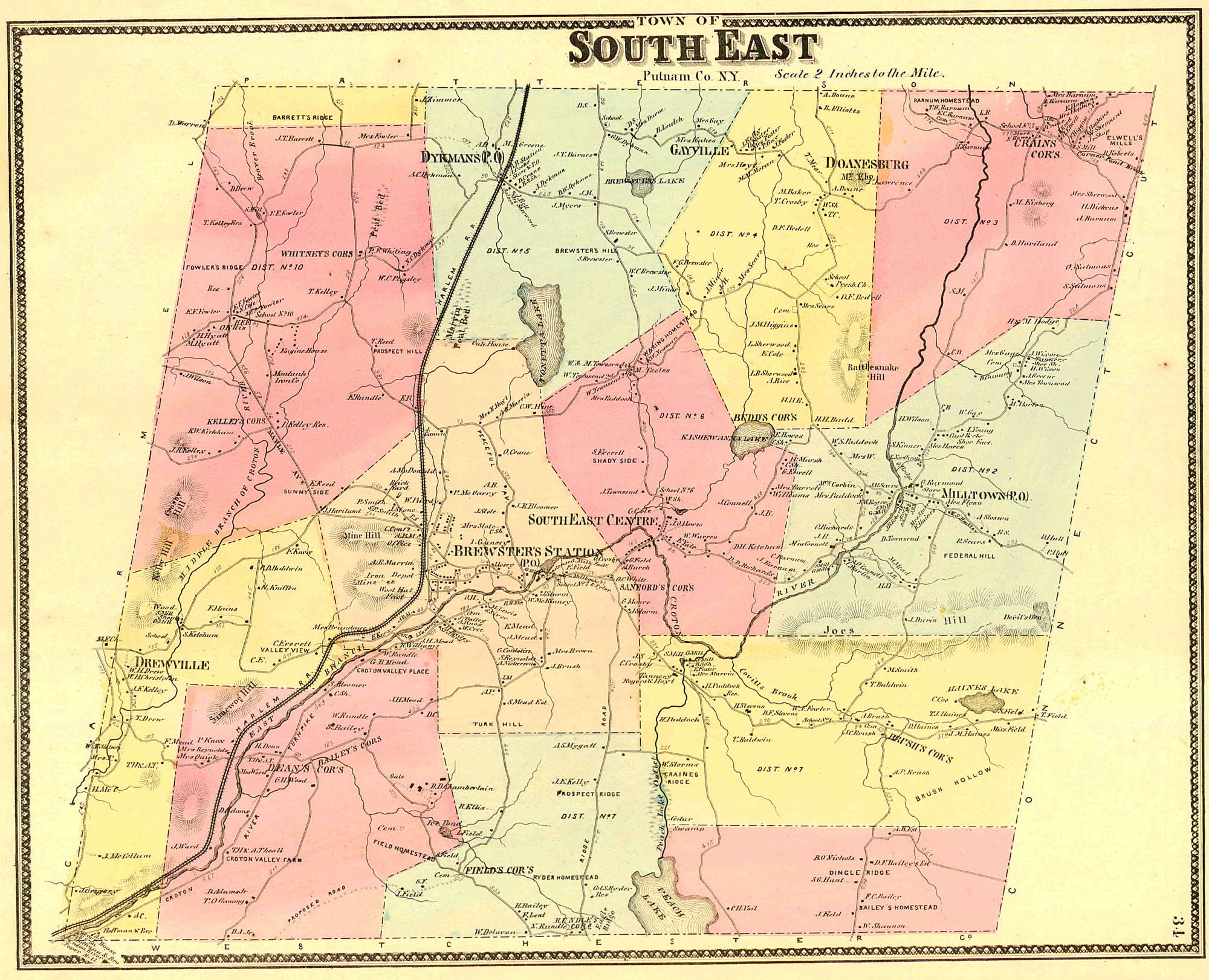
Plan of the town of South-East
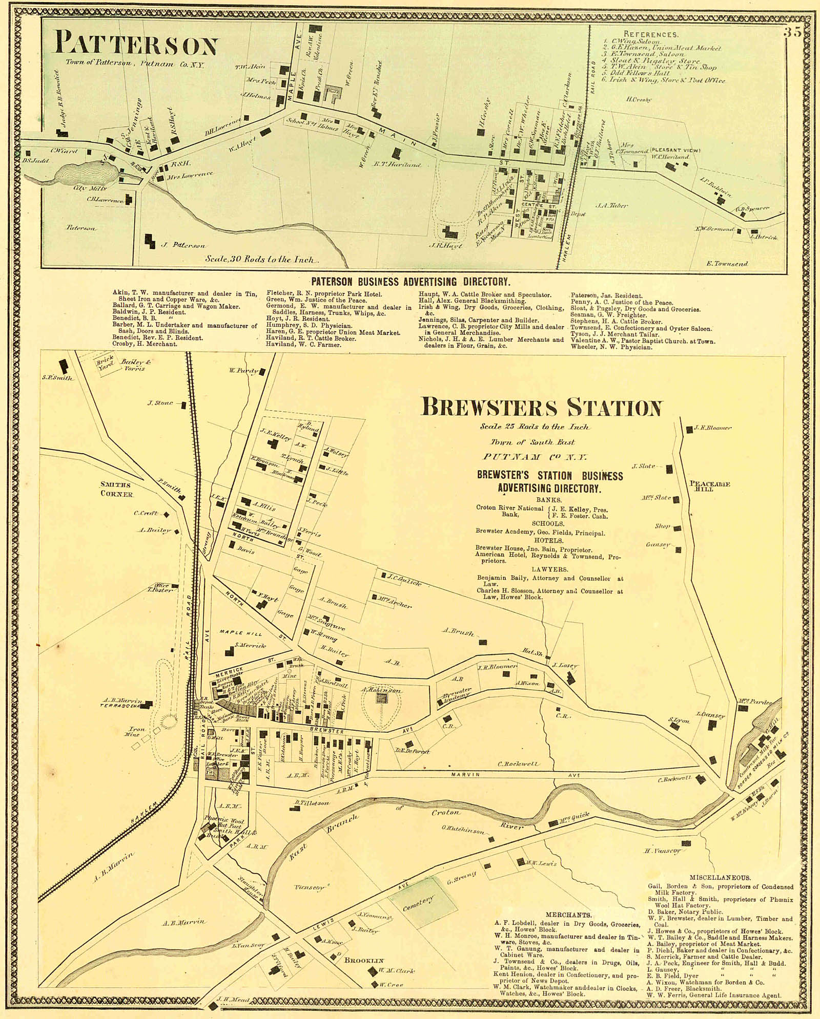
Plan of the villages of Brewster's Station and Patterson
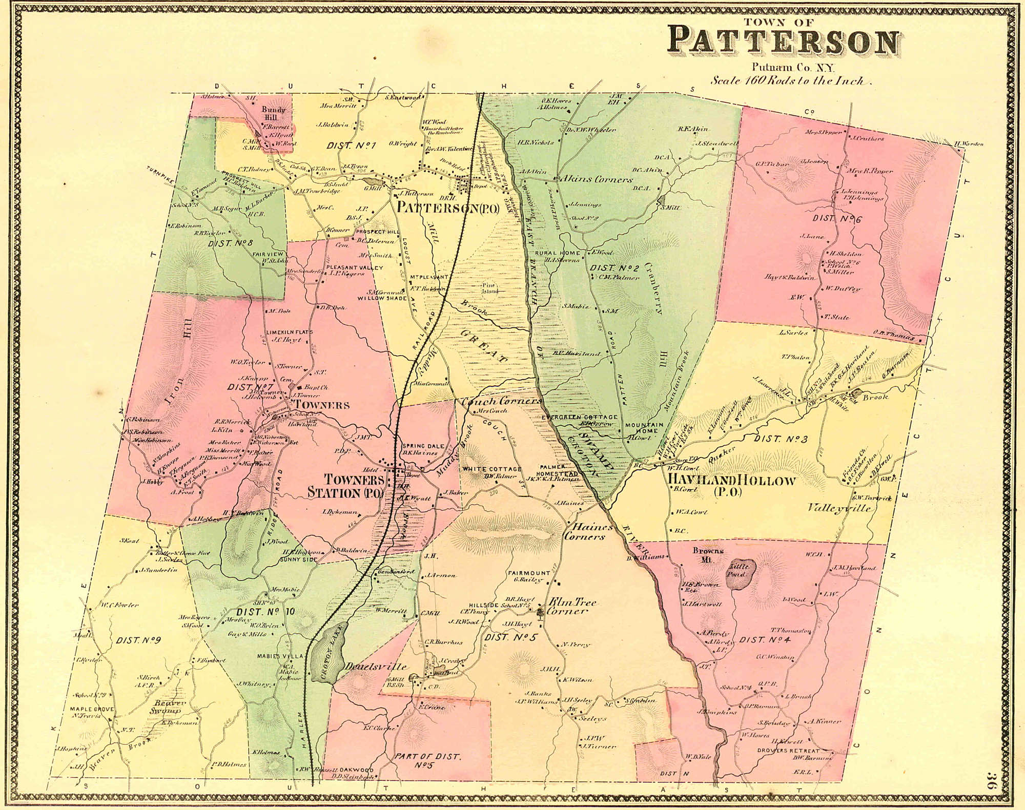
Plan of the town of Patterson
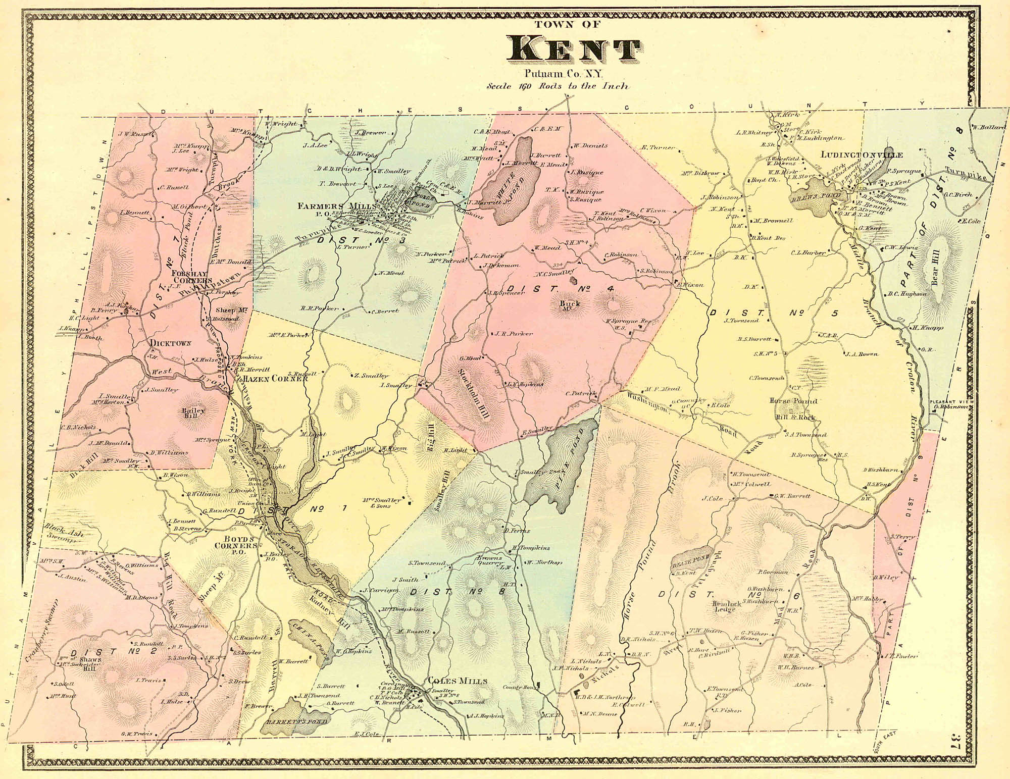
Plan of the town of Kent
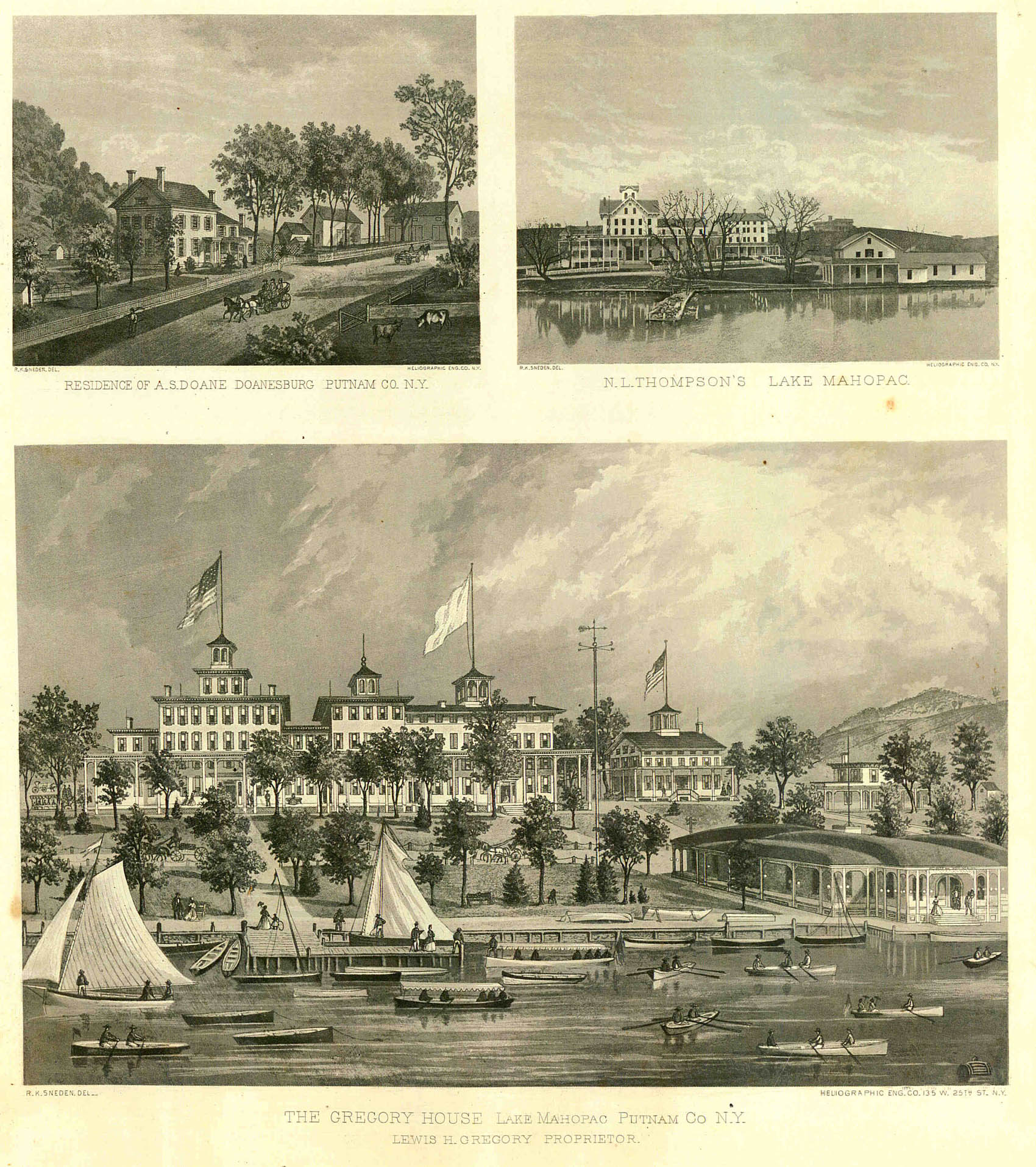
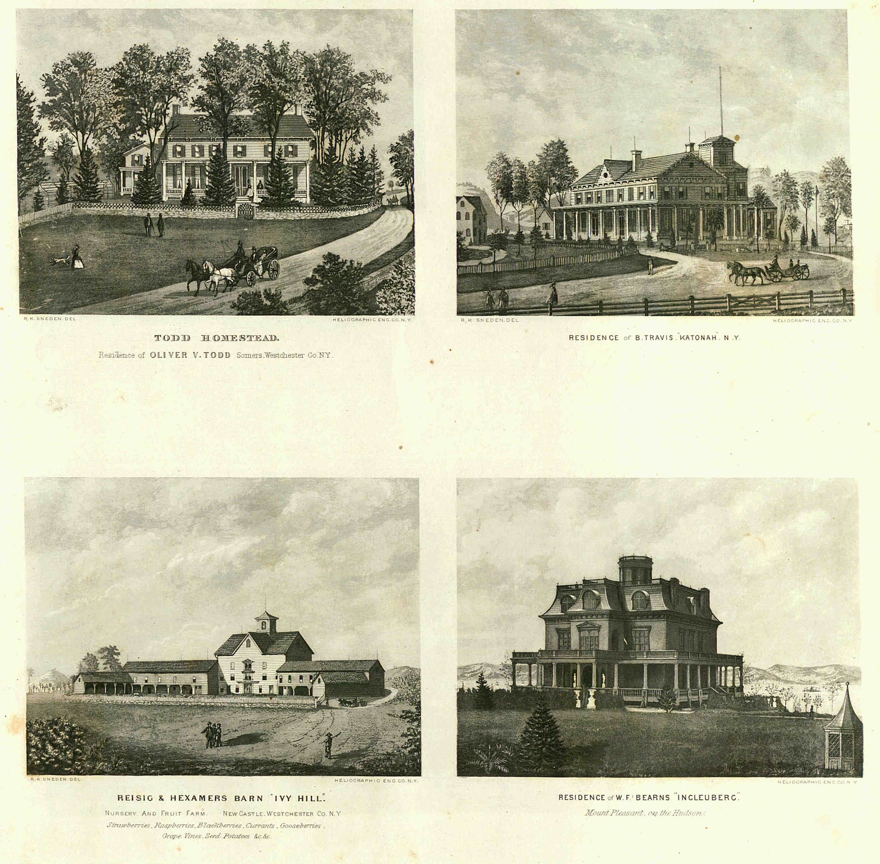
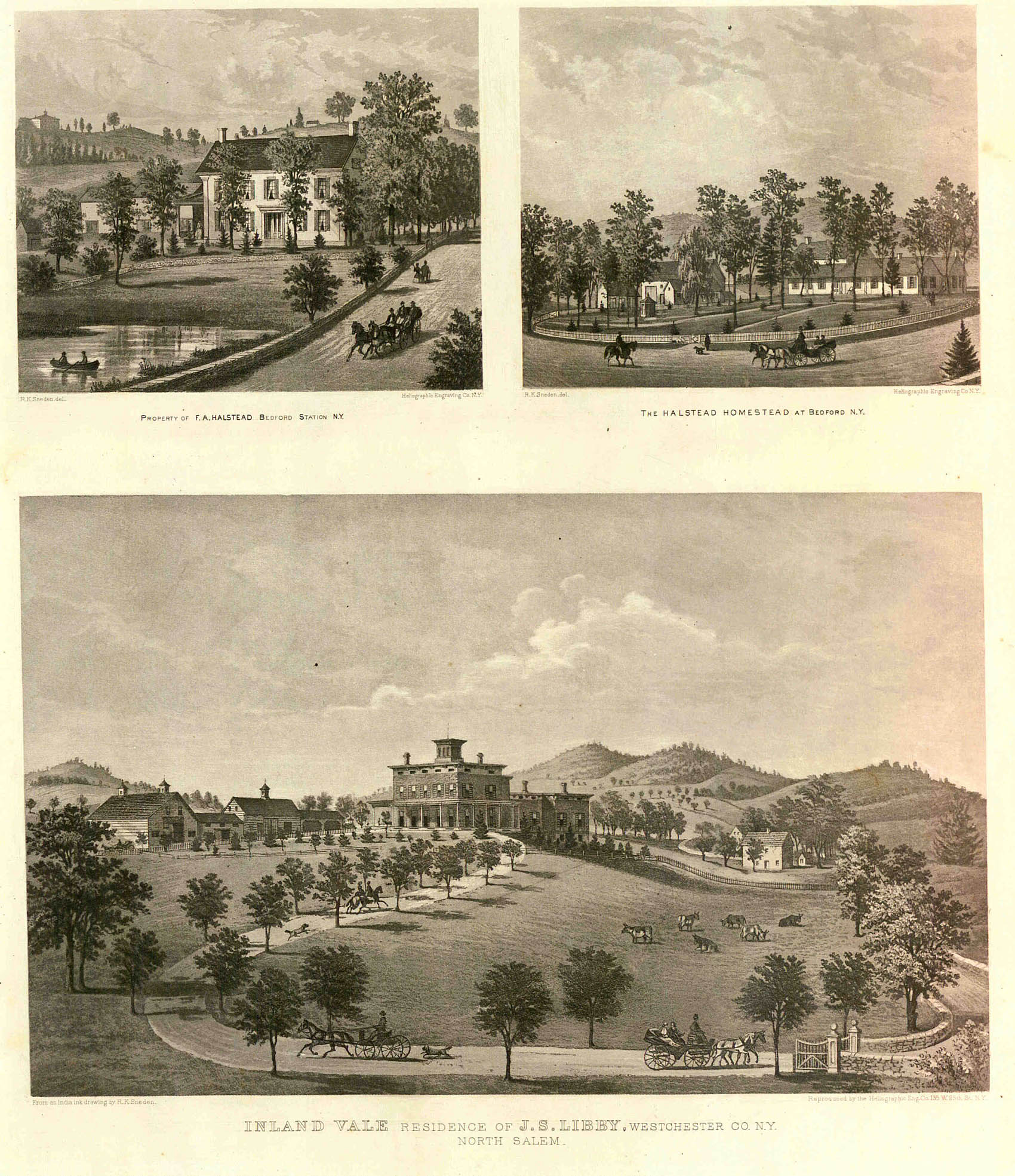
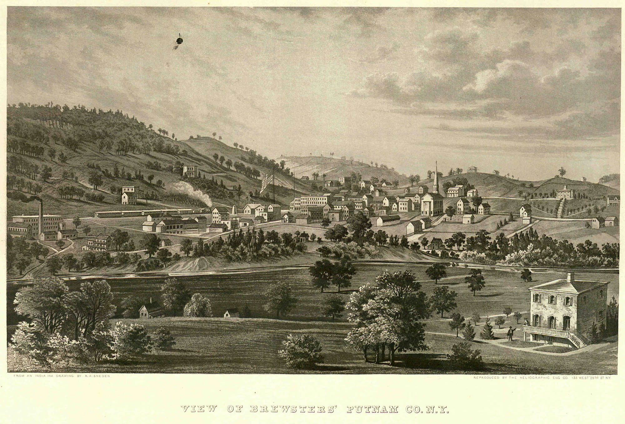
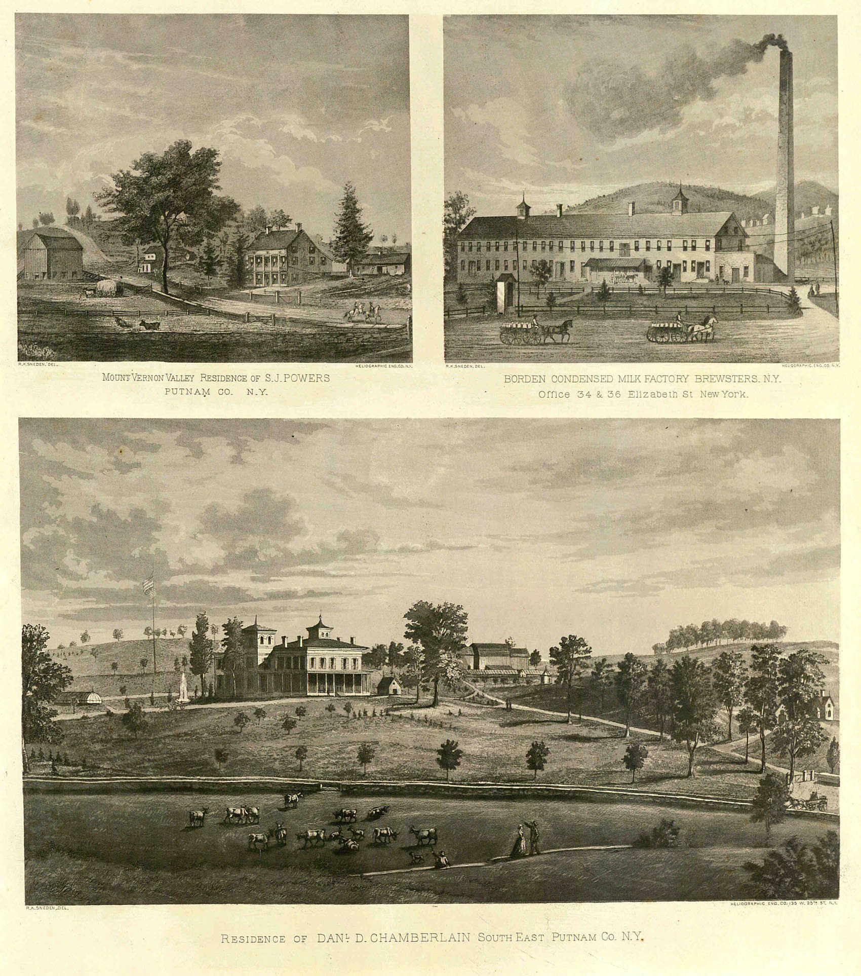
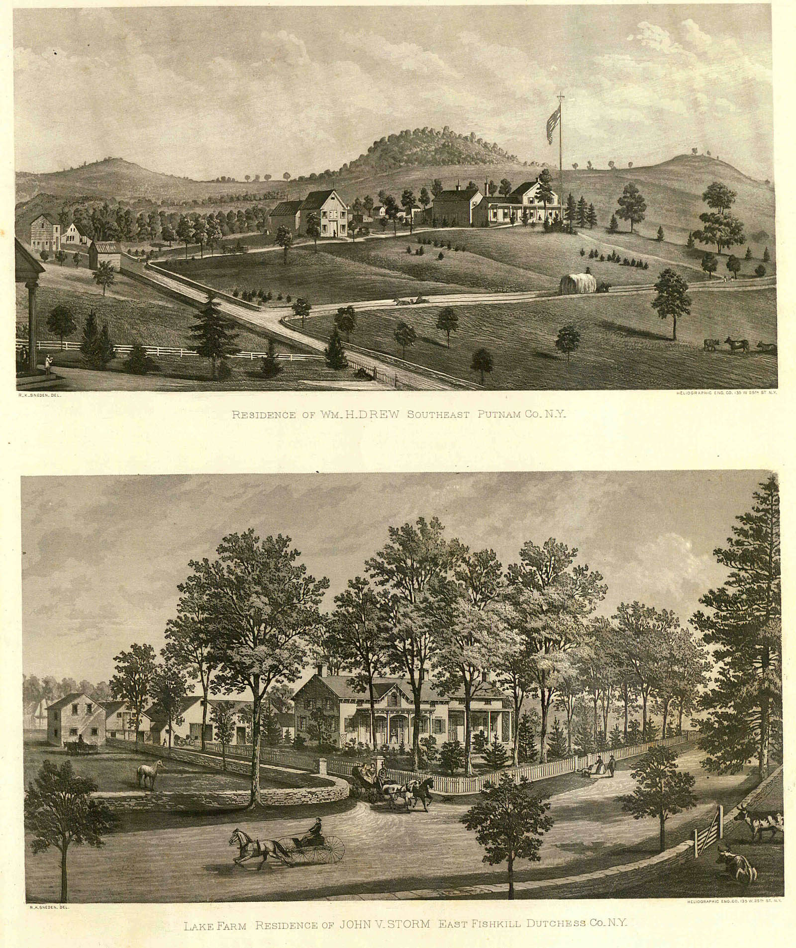
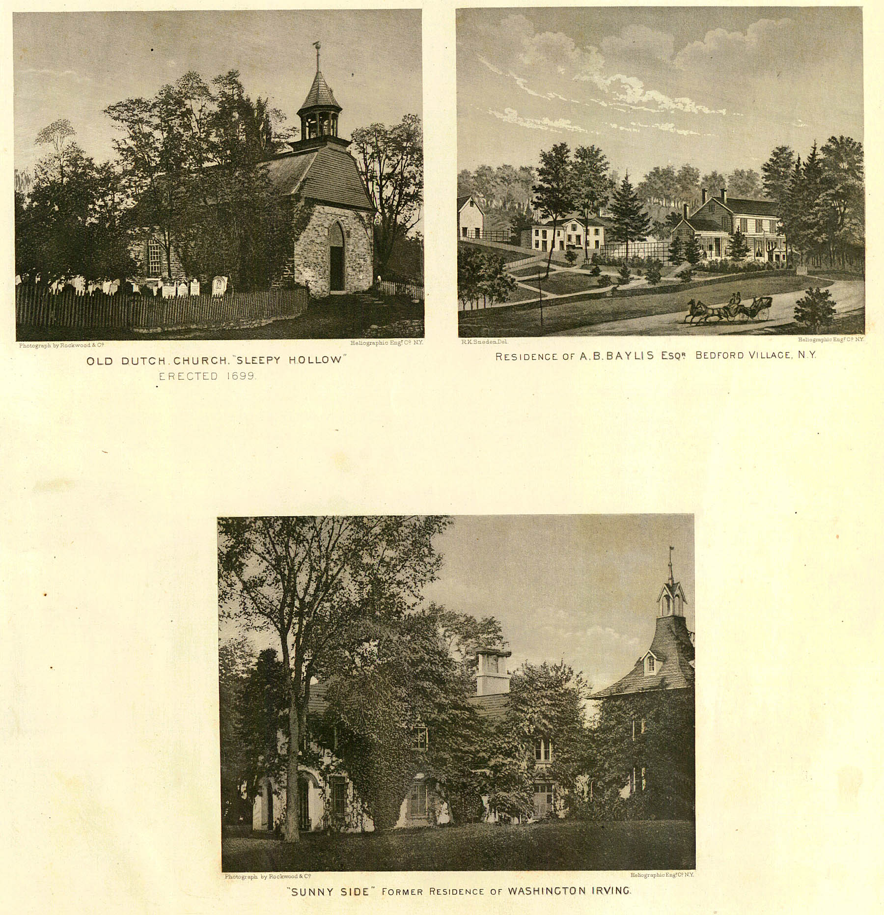
Views
Views
Views
Views
Views
Views
Views